

Hidden stops along the Diamond Circle Iceland
Hidden Stops Along the Diamond Circle Iceland
The Diamond Circle Iceland route covers around 250 kilometres (155 miles) of North Iceland's most dramatic scenery. Most travellers stop at the same five well-known sights and then move on. The route holds far more, though, once you look past the main car parks and viewpoints.
From a lava cave near Mývatn to a valley made for horseback riding, these spots reward travellers who slow down. This guide looks at some of the most overlooked attractions on the Diamond Circle and how to fit them in.
What Is the Diamond Circle in Iceland?
The Diamond Circle is a driving route that loops through North Iceland, following the Ring Road and connecting roads. It links waterfalls, geothermal areas, and a horseshoe-shaped canyon carved by glacial floods centuries ago. The full loop takes around four hours of driving, though most travellers prefer to spread it across two or three days.
The landscape changes constantly along the way. One stretch passes lava fields and steaming vents, while the next reveals open farmland or a coastal town. This variety is part of what makes the Diamond Circle Iceland loop so rewarding for a longer stay.
Hidden Stops Around Lake Mývatn
Lake Mývatn has plenty of quieter corners that sit just minutes from the busier viewpoints. They take a little extra time but add real depth to a Diamond Circle itinerary.
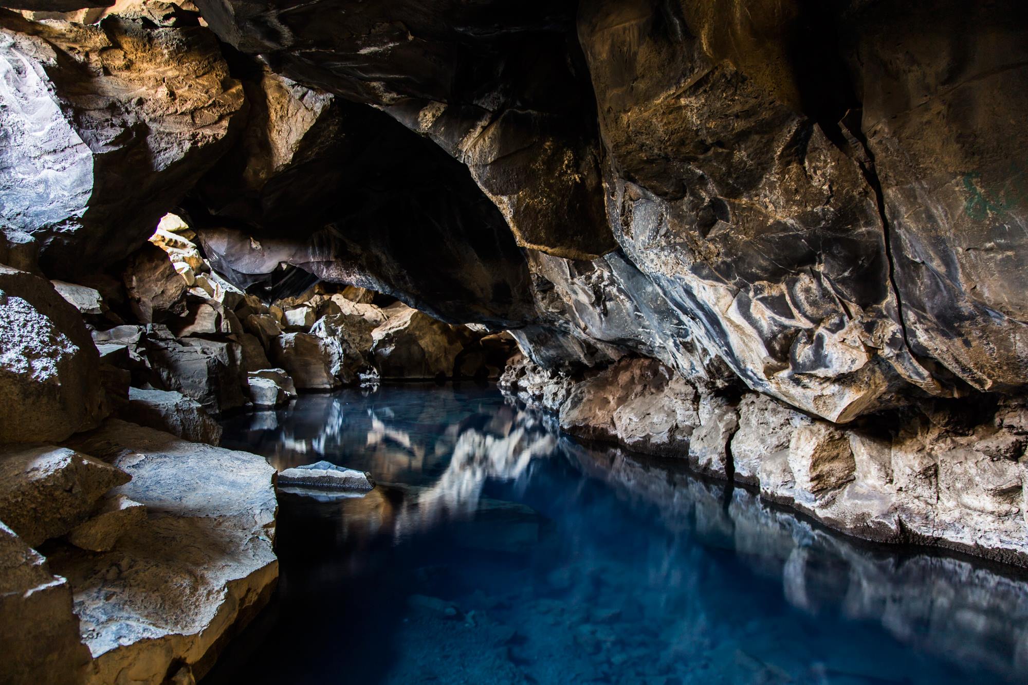
Grjótagjá Cave and Stóra-Víti Crater
Grjótagjá is a small lava cave with a hot spring pool inside. Bathing is no longer allowed because the water temperature now fluctuates unpredictably. Even so, the cave remains one of the area's most photogenic stops. Its dark rock walls and bright blue water make for a striking photo.
A short drive away, in the Krafla volcanic area, sits Stóra-Víti crater. Its crater lake holds pale blue water that contrasts sharply with the black volcanic ground around it. Marked paths circle parts of the rim, giving wide views over the surrounding geothermal areas without a long walk.
Höfði Peninsula
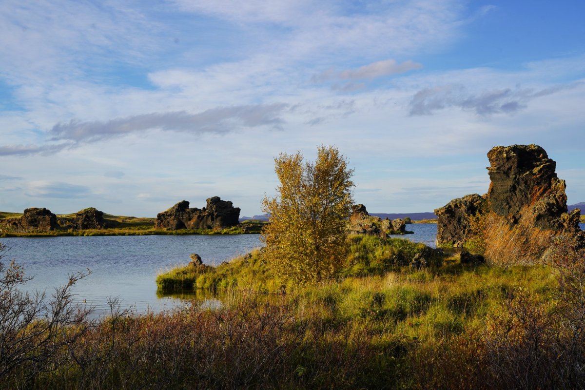
Höfði is a quiet, wooded peninsula reaching into Lake Mývatn. Walking paths wind between birch trees and basalt rock formations along the shoreline. Several short loops suit a stop of thirty minutes to an hour. The peninsula is also a reliable spot for birdwatching, particularly during the summer months when nesting birds are most active.
Höfði rarely appears on a standard Diamond Circle itinerary, which is exactly what makes it worth the stop.
What Hidden Rock Formations Can You Find Near Ásbyrgi?
Jökulsárgljúfur National Park, near Ásbyrgi Canyon, is home to some of North Iceland's most unusual basalt formations. These quieter stops showcase landscapes shaped by volcanic eruptions and powerful glacial floods, yet many travellers pass them by.
Hljóðaklettar (Echo Rocks)
Hljóðaklettar, meaning "Echo Rocks," sits in Jökulsárgljúfur National Park, a short detour from Ásbyrgi Canyon. The area is known for its unusual basalt formations, shaped into columns, arches, and caves by ancient volcanic activity and glacial floods. Several marked hiking trails lead through the rock formations, with routes ranging from short walks to longer loops. Despite being close to some of the Diamond Circle's busiest attractions, Hljóðaklettar remains one of the route's quieter places to explore.
Karl and Kerling Rock Formations
A short walk from Hljóðaklettar brings visitors to Karl and Kerling, two distinctive basalt pillars whose names mean "Old Man" and "Old Woman." According to Icelandic folklore, they are trolls turned to stone by the rising sun. The formations rise from the lava landscape and add a cultural element to the area's volcanic scenery.
A Quiet Detour off the Diamond Circle Route
Bárðardalur valley sits south of Goðafoss and offers a slower pace away from the main driving route. It is one of the longest-inhabited valleys in Iceland, with farmland stretching along the river. The valley rarely appears on a typical Diamond Circle itinerary, which is exactly why it is worth the detour.
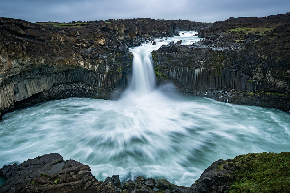
Aldeyjarfoss and Hrafnabjargafoss Waterfalls
Aldeyjarfoss waterfall drops through a frame of dark basalt columns on the Skjálfandafljót river. Many photographers consider it one of Iceland's most striking waterfalls, despite its distance from the busier stops on the loop. A short drive further upriver leads to Hrafnabjargafoss, a quieter waterfall surrounded by volcanic landscape.
Both falls sit within the Magnificent Valleys area, alongside several other waterfalls worth visiting on a longer Bárðardalur detour.
Horseback Riding at Eyjardalsá
For a different way to see Bárðardalur, Eyjardalsá Horse Riding runs guided rides from a working farm in the valley. Tours suit both first-time riders and experienced ones, with routes that follow the river and surrounding farmland. Booking ahead is recommended, since tours run by request rather than on a fixed schedule.
Three More Unique Diamond Circle Stops
Three more unique places sit a little further from the main loop, for travellers with extra time to spare. While Askja requires a full-day detour, Grenjaðarstaður and Vaglaskógur are easier to include along the route.
Askja Caldera
Askja is a large caldera deep in the Icelandic highlands, reached by gravel roads from the Mývatn area. Its crater lake, Öskjuvatn, holds deep blue water against dark volcanic rock. The drive in usually takes a full day and is only possible during the summer months.
Grenjaðarstaður Turf Farm
Grenjaðarstaður is one of Iceland's largest turf farms, with a church beside it. The site once housed local chieftains and now gives a quiet look into rural Icelandic life. It sits in Aðaldalur valley, a short detour from the main Diamond Circle route.
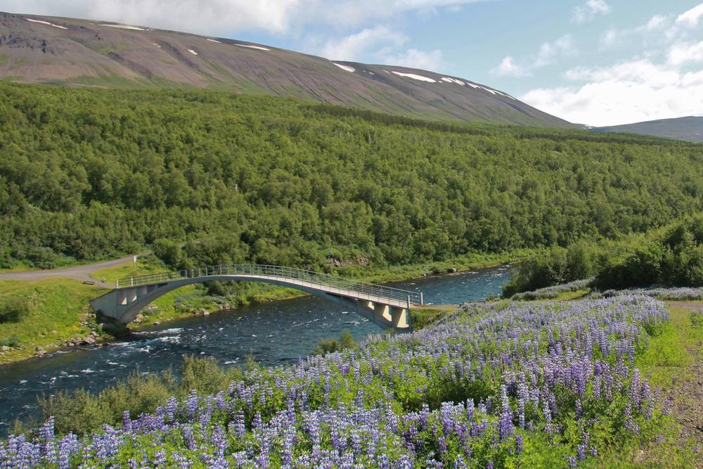
Vaglaskógur Forest
Vaglaskógur is the largest birch forest in Iceland, located in the Fnjóskadalur valley. A stone arched bridge from 1908 still crosses the river at the forest's edge. It remains one of the quietest woodland walks on the entire Diamond Circle route. Marked trails suit both a short stop and a longer one.
Can I Self-Drive the Diamond Circle?
Most travellers complete the route as a self-drive trip. The roads are well-marked, and rental cars are widely available. A reliable car, regularly checked road conditions, and some flexibility are usually all that is needed.
Travellers wanting a more personal pace, particularly for trips into the highlands near Askja, may prefer a private guide instead. Kristinn, the Tour Guide, offers jeep tours around North Iceland and the highlands. Routes are built around what each traveller wants to see.
Best Time to Visit These Diamond Circle Stops
Many of these unique places are accessible throughout the year. Grjótagjá, Höfði, and the geothermal areas around Krafla stay accessible through winter, weather depending. Hljóðaklettar can also be visited year-round, although trail conditions may vary in snow. Aldeyjarfoss, Vaglaskógur, and Askja are easiest to reach in the summer months, when roads stay clear, and daylight runs long. For a full Diamond Circle itinerary, our one-, two-, and three-day guides cover timing for each season.
Plan a Slower Diamond Circle Trip
The Diamond Circle Iceland loop holds far more than its five best-known stops. Lava caves, basalt rock formations, quiet forests, remote waterfalls, turf farms, and horseback riding all sit within easy reach of the route. Building extra time into your itinerary turns a quick drive into a richer journey through North Iceland. For more background on the wider area, read a travel guide to Lake Mývatn before setting off.
FAQs
What is the Iceland Diamond Circle?
The Diamond Circle is a roughly 250-kilometre (155-mile) driving loop in North Iceland. It connects Lake Mývatn, Dettifoss, Ásbyrgi canyon, Goðafoss, and Húsavík.
How long does the Diamond Circle loop take to drive?
The full loop takes around four hours of driving without stops. Most travellers spend one to three days properly exploring the attractions along the way.
Do you need a 4x4 to drive the Diamond Circle?
A 4x4 is not required for the main route in summer. Winter driving, especially on side roads or toward the highlands, is easier and safer with one.
Is the Diamond Circle route open in winter?
Most of the route stays open in winter. Some roads close once snow falls, including the road to Dettifoss. Check road conditions before setting out.
How far is the Diamond Circle from Reykjavík?
The Diamond Circle starts around 388 kilometres (241 miles) from Reykjavík, near Akureyri. The exact distance depends on which stop on the loop you measure to.